I dropped into my local library to pick up this great book
about Ushuaia and Tierra del Fuego (of course it was available to me through our provincial library system,
Tracpac). Talking with the librarian,
she asked if I was interested in giving a presentation to the local seniors’
group at the library. Hmmm, how to hit
the interesting bits of five months of travel in half an hour or so (leave time
for tea and some lovely cake). Just to
make it more complicated, I also included a bit about Metis sash weaving and
my favorite library books.
The trip
After flying to Rio de Janiero, I spent almost five months traveling overland in an orange and white truck to Cartagena by way of the southern most tip of South America at Ushuaia. The distance was almost 20,000 km.
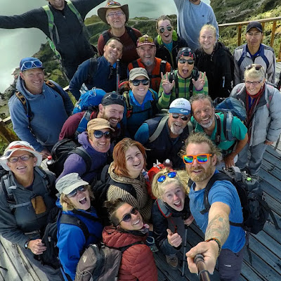 |
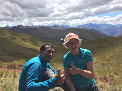
| Here's our group selfie at Quilotoa, a crater lake in the Ecuadoran cloud forest. About half these people had been with me from Rio de Janeiro, while others had joined the group along the way. You really get to know the people you live with. Thanks, Lee Hobson @nine3zero for sharing your photos. |
The book
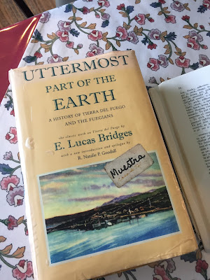 |
| Here's the book that I was excitedly picking up at the library. Another copy, actually, because this is the one I saw at Estancia Harburton near Ushuaia. We were having tea with Tommy Goodall, the great nephew of the author, and the husband of Natalie, who had written the forward to this 2007 edition of the 1938 classic. It's on my list of must read books about South America. |
Metis SashWeaving
I had recently taken a class in finger weaving and borrowed books from the library then bought my own copies to learn more. As we traveled, I was creating my own finger weaving panels as memories of the journey. Read more about it
here. I had heard that the indigenous people in Peru also did finger weaving and was watching for examples.
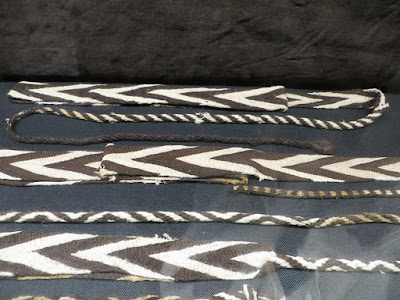 |
| The museum in Santiago, Chili had an exhibit on pre Inka peoples where I saw these finger woven sashes from more than 3000 years ago. Textiles, I discovered, survive for centuries in the high altitude deserts. The note on this display indicated that llamas and alpacas were domesticated 5000 years ago and weaving comes from about that time as well. These skills were passed north, "where we believe that indigenous people still use this skill". |
 |
| At Isla de la Luna, Bolivia, on Lake Titicaca. We had stopped here to see the temple to the moon which was almost the farthest east that the Inka had come - Bolivia's Aymara people predate and were not conquered by the Inka. To my surprise and delight, this lady was fingerweaving these sashes as she waited for tourists to purchase her items. Frank was looking for a strap for his camera and lent me money to purchase one for myself. |
Big Cities
Coming from a small northern town in a country that is very sparsely populated, spending time in a huge city has its fascination (in small doses). Major cities in South America are huge - Buenos Aires has 18 million people - and are where you can see the diversity between the extremely wealthy privileged classes and the rest of the population. We learned in Arequipa, for example, that where you lived defined your class, which in turn defined which schools you could go to and the types of jobs you were eligible for as well as who you could marry.
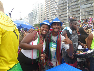 |
| Some photos from Carnival at Rio de Janeiro. The bloco at Copacabana starts at 9:00 in the morning and has an estimated 200,000 participants, many in costume and all partying happily. I was standing quietly watching the crowd when these merchants signaled that I could/should take their photo. I also learned that it was ok to tuck into a group heading in my general direction with smiles all around. I try to think of a big football or hockey party in Canada without violence or destruction of property. |
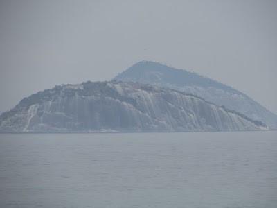 |
| For contrast, from the same beach, a photo of nearby islands. |
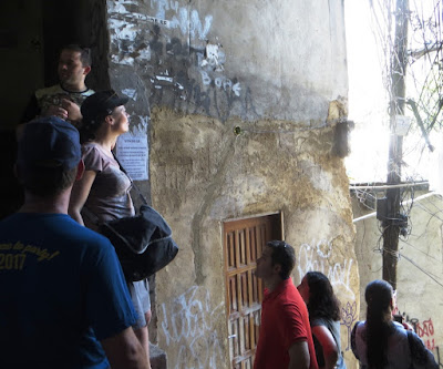 |
| Rochina favela tour. We had stopped part way down a footpath for our guide to tell us another story of life in the favela. At this location, a tour group had stopped because a drug deal was going down just below. Like our group, they had been told to not take photos of people without permission. In this case, though, a tourist stepped into the open and took a photo of what was happening below. He was noticed and promptly shot. Our guide mentioned that the entire favela held their breaths waiting for the reaction of the police and of the drug gang (think explosion of violence). Instead, when the drug lord was informed of what had happened - stupid tourist, gang member too fast to react - the member was turned into the police and violence was averted. Each big city in South America has their favelas (Portuguese speaking Brazil) or barrios (the Spanish speaking countries) that were fascinating to explore with a local guide who knew where/when it was safe and who could translate what we were seeing. As a note, in December 2017, this favela exploded into violence with new attempts of organized crime to increase their presence in the community and the military/police pushing back. |
 |
| From the other end of the trip. This fascinating office building is just off the main square in Medellin, Columbia. We had been exploring the Botero statues, and the historic buildings, but my sewer's mind was drawn to this building in the background - looks like a machine sewing needle, thought I. Sure enough, this is exactly what it is supposed to look like. Medellin is well known in South America for its textile trade - not creating fabric, but creating garments. |
Mountains
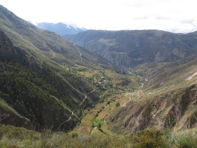
The mountains of South America are incredible. I had always assumed, looking at maps that show the mountains stretching from the Arctic past where I live and then south through the United States and then down the spine of South America, that they would be similar to the Canadian Rockies. Not at all. In South America, the plates pushing against each other create volcanoes and earthquakes rather than folds. We passed many active volcanoes (some of my fellow travelers climbed them) and there was an earthquake while we were in Santiago. In the south, we passed Aconcagua, at 6900 meters the highest mountain outside of the Himalayas. It actually rises higher above its plateau than Everest. As we came north, the altiplano of Bolivia and Peru sits between 3000 and 4000 meters - so valley floors being higher than the highest mountain in the Rockies. As we traveled from Buenos Aires to Santiago and then onward to Bolivia, we actually crossed the Andes seven times.
The other difference is that the Humboldt current which comes from Antarctica and passes the coast of Chili reverses what I think of typical mountain weather. Air passes over the cold ocean water it actually sucks up moisture as it heads across the mountains (so west of the mountains it is dessert). As it passes the summit, it starts to drop moisture, creating the higher altitude cloud forests then rain forest as it drops past the tributaries of the Amazon. Standing in scenery that looked vaguely like southern Alberta looking toward the mountains just convinced my horrid sense of direction that I was looking west not east :)
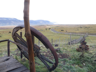 |
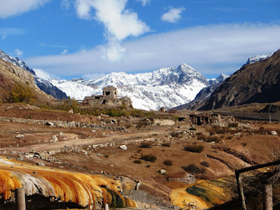
| Heading to Perito Moreno Glacier from El Calafate. The town felt like Banff or Jasper with all its tourists and high end gear for climbing the nearby mountains. We stopped at this estancia for a loo break and coffee and this scene reminded me of the foothills around Calgary (although the mountains were on the wrong side). One of the reasons was that the local ranchers, after grazing too many cattle on the poor ground had seeded with wild Alberta grasses hoping that they would grow! I guess there are a few things we do better as our land is more fertile. |
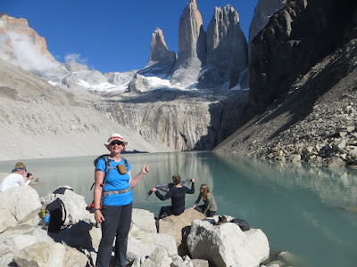 |
| I made it!!! First major hike to Mirador Torres del Paine (the lookout to the Blue Towers) in the southern Pantanal. Great guides and first time for my fellow travelers to cheer me when I finally made it. |
 |
| The last kilometer path was a 300 meter elevation gain on volcanic scree. |
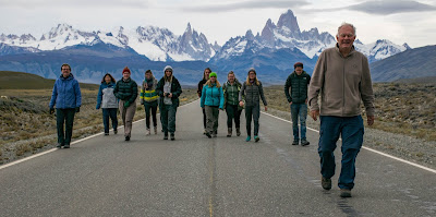 |
| Group selfie with Mount Fitz Roy in the background. The border between Chili and Argentina passes through the summit. Thanks again to Lee Hobson for setting up this great photo and sharing it. |
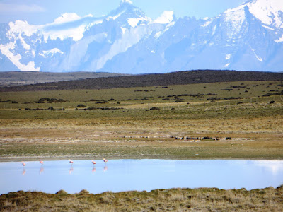 |
| Heading north toward Santiago on the Chili side. Again, this struck me as so similar to the Alberta foothills. Except for the flamingos in the pond in the foreground. And this stretch of mountains are all above 6000 meters. And we are looking east. |
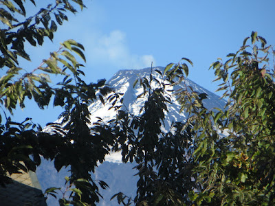 |
| View of the active volcano near Pucon from our hostel. It is steam not clouds coming from the top. Some of my fellow travelers climbed it. I went whitewater rafting. |
 |
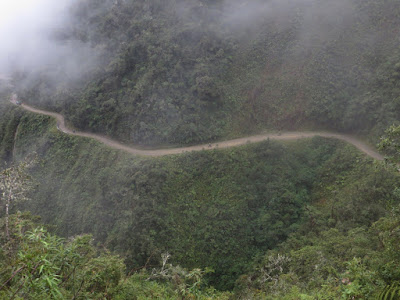
| Typical mountain roads. Almost all the roads in the Andes are following trails created by the Inkas. |
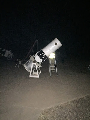 |
| San Pedro de Atacama in northern Chili is like an oasis in the desert (why the Spanish first settled here) and is an international astronomical site due to the lack of light polution. It sits at a "low" 2500 meters on the edge of the altiplano. |
 |
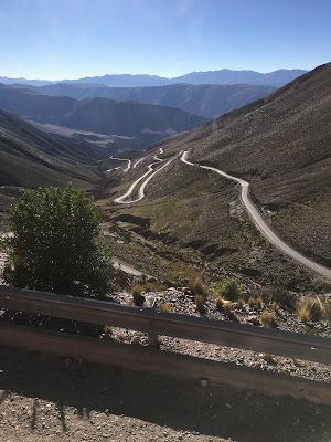
| Heading from Santiago to Mendoza through the Paso de los Libertadores. The summit/border crossing is at 3200 meters and the switchbacks are numbered. What fascinated me is that this is the route that San Martin and O'Higgins took in the 1830s in their war to liberate the area from the Spanish. |
 |
| View from the Inka Bridge. Note the ruins of a 16th century dry mount church to the right. Yup, the Inka were using this pass six hundred years ago. |
 |
| Biking the Death Road near La Paz. I was traveling with the support vehicle. Coming in to La Paz through the mountains from the west, I thought Bolivia was arid desert. This road comes from La Paz to the east and drops rapidly into the Amazon as the main supply road to and from Brazil. Cloud forest. Bikes are on the road in the center. To the left is the place where a passenger bus went off the edge killing all on board. As a result, traffic on this road is now opposite to what is the case everywhere else in Bolivia. Driving on the left means that traveling uphill you are against the hill if you have to back up for oncoming traffic. Yes, this major road is single lane and gravel and the rule of the road is that going up gives way. |
 |
| Salt flats at Uyuni and the iconic photo to show you were there. We were at about 4000 meters with mountains surrounding us in the distance. |
 |
| The road from the border with Chili. One of the functions of the local guide who met us at the border was to help us navigate along the "road" which was basically the track made by vehicles crossing the salt flats. |
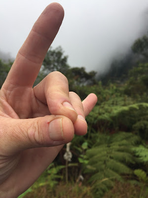 |
| The Happy Llama. Traditional Andean signal taken over by yoga folks. And modified by heavy metal folks. |
 |
| Hiking the Wild Andes Trek between Cuzco and Machu Picchu. With our guide, Juan, we had just passed the 5100 meter summit of the pass and were heading down toward our first night camp. So what looks like gently rolling foothills is actually rising from a valley of about 3500 meters. Nothing in South America was flat. I had had to spent the first part of the day reassuring Juan that I was not having problems with altitude, I was just slow. Then we had to reassure the shaman who kept checking on me and wanting to carry my pack with his gear. He finally gave me the flowers in my hat as a blessing. |
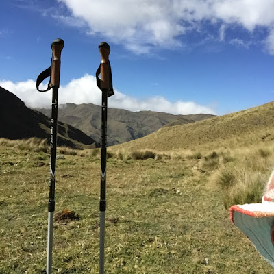 |
| With my trusty poles I can manage just about anything. |
 |
| The rest of the group were fifteen minutes ahead of me, and I got a cheery welcome when I came around the corner. |
 |
| On the coast in northern Peru. The winds coming off the ocean dessicate and create incredible sand dunes. |
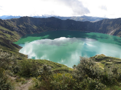 |
| Quilotoa crater lake in the cloud forest between Cuenca and Ecuador. We're at about 4000 meters and hiked from here back to our hostel at 3200 meters. We got picked up part way because of a torrential downpour and got to drive some incredible mountain tracks. The children near this lake have to hike the 10 km to school every day. |
 |
| View of the clouds coming in. Cloud forests had a completely different ecology from the rain forest because of the altitude which creates a colder although very wet climate. |
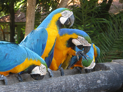
Camels and Penguins
Of course the birds were incredibly beautiful and brightly coloured. And as overlanders we got to see animals that I had never seen before. Here's a few of my favorites.
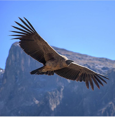 |
| Another beautiful photo from my fellow traveler, Lee Hobson. Condor in Colca Canyon in southern Peru. It was a great morning viewing these magnificent birds playing with the updrafts. We had been warned that we might not see any Condors (they are wild animals...) but instead, over the period of an hour or so we saw 24 of the 33 resident birds. As we were watching these birds, I was thinking about one of my favorite songs - Paul Simon's El Condor Passa (If I Could), and which I had been hearing in many occasions as we traveled through the Andes. Turns out this is a great story of cross cultural connections. Apparently, he heard this song at a folk festival being played by another group and asked who it was written by - and the group claimed they had. So, Paul Simon wrote words and credited this other group with the melody. Almost instantly on release, everybody with a Spanish connection knew the real story - that the melody had been written by a Peruvian composer for a 1920's musical that was known through out South America. When contacted by the composer's son, he instantly agreed to list the actual composer, Robles, and to change the title of the song to include Robles' title. And the son wrote the Spanish words. It's now the second national anthem of Peru. |
 |
| Lunch break traveling in Patagonia. Us imitating the seals behind us. Another Lee Hobson creation. |
 |
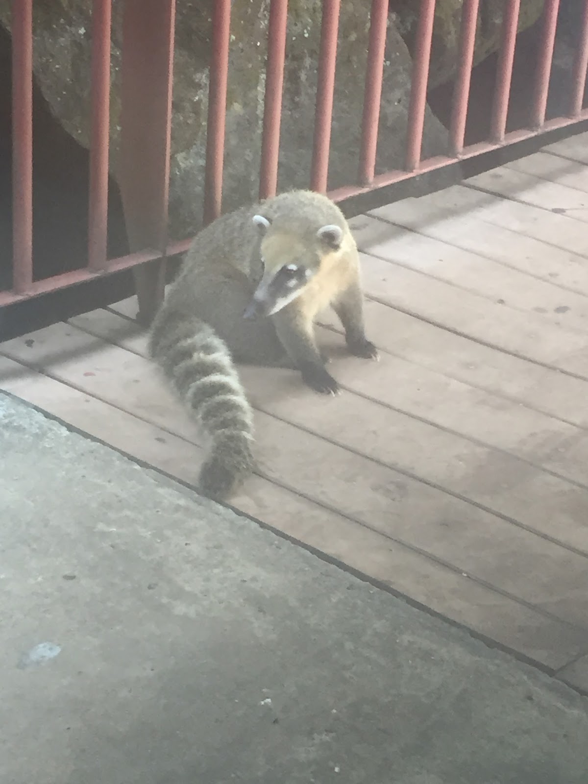
| A coati at Foz do Iguazu. We were warned how vicious they were - they had been known to injure toddlers in attempts to get food. Cute but keep your distance. |
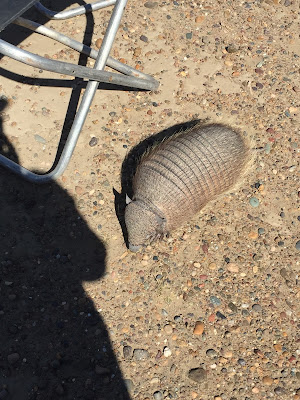 |
| I think we were checking out penguins or seals, but this armadillo was way more entertaining in the parking lot. Sort of like taking my children to the zoo, only to have them get more excited about the gophers in the playground. |
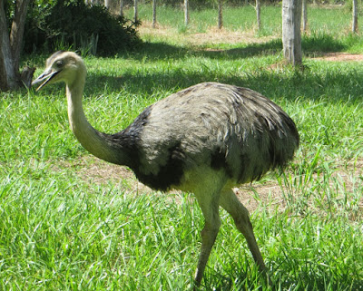 |
| Rhea, a type of ostrich. Rhea was the name of our tent from Rio de Janeiro to Santiago. |
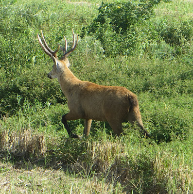 |
| A North American deer in the Pantanal. Imported because somebody thought it would be a great idea. Apparently quite rare, but we saw three or four. |
I have a soft spot in my heart for Camels and Penguins. We had a chance to get up close and personal with four of the different species of penguin that make their homes in South America, and I even got to swim with a Galapagos penguin who hopped into the water as we were snorkeling in one of the caves.
 |
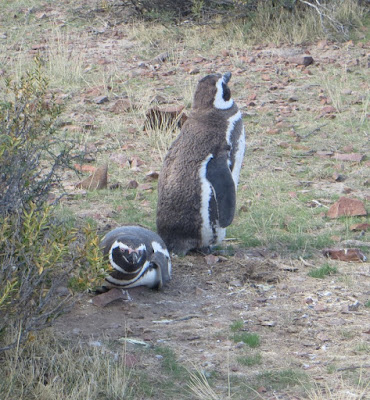
| Megellantic penguins near Puerto Madryn. They seemed to not even notice that we were watching. |
 |
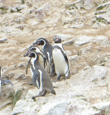
| These were on an island in the Beagle Chanel as we traveled to Estancia Harburton. The dark brown one standing would be a chick. |
 |
| And these fellows are Gentu penguins, much more rare, and were mixed in with the Megellantic ones. |
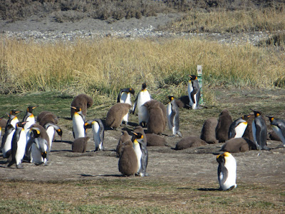 |
| King Penguins on Tierra del Fuego. The only colony on the mainland - they are mostly found on the subantarctic islands and antarctica. This group had arrived in 2006 and were officially considered a colony (not just visiting) as of last year when one chick survived. The brown birds are this years new chicks; yes they rapidly become the same size as their parents. |
 |
| These are the Galapagos penguins. |
Before I left Canada, I was reading about llamas and alpacas, trying to figure out what was the difference and learned that they are actually camelids , AND that they also have two wild relatives, the guanacos and the vicunas. From what I had read, it was going to be easy to see llamas and alpacas but that it would be very rare to see guanacos or vicunas, who were wild, skittish, rare, and lived out in the wilds. The real story was almost completely different - one more vote for overlanding.
 |
| Actually, the first camels we saw were the Guanacos as we were traveling through Patagonia. Pronounced as Huanaco. I have a number of very blurry pictures of our first encounters, but we were actually hiking near Torres del Paine in Chili when we passed this group. I remember commenting to my fellow travelers that I wished there were trees or bushes that I could collect some fleece from for my memory quilt. Annette and Kate looked at me funny, walked over to the barbed wire fence and removed several clumps for me :) |
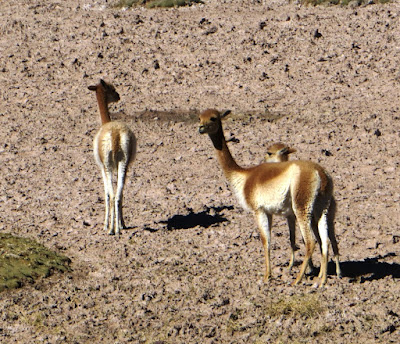 |
| These are vicunas and they live on the altiplano. This group were actually with a group of alpaca just as we were coming out of San Pedro de Atacama. Our guide explained that vicunas are protected and you are not allowed to harm them, but if you should happen to convince one or two to hang around with your alpacas, you are welcome to harvest their fleece, every three years. Which is why vicuna yarn is about 300 USD per oz. |
 |
| The alpacas. You can tell they are alpacas because they are hanging in a group and because of the bright yarn tassels that tell you who they belong to. Up close, you'd notice that they are smaller than llamas. Alpacas have been domesticated for about 5000 years in South America and are chosen for their fleece. |
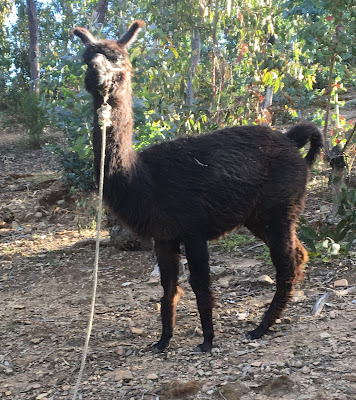 |
| Llama on the Isla del Sol on Lake Titticaca. He was taller than us. Llamas are considered as beasts of burden and their fleece is not considered suitable for spinning and weaving (even though I thought it was pretty soft). In some communities, men would take llama fleece and spin it to weave fabric for bags to hold produce. The other thing about llamas was how the word was pronounced depending on where you were. It was jama or zama, or yama or sama but never lama. |
 |
| This is also a llama who was hanging out at Maccu Pichu for the photo ops. |
Inkas
When I think about South American indigenous groups, my first thought is the Inkas. What I learned while traveling is that they weren't the first, or the longest lasting, and they didn't really invent anything in particular. They arrived in the Cuzco area in the mid 1300s and were incredibly effective at taking over local groups and integrating them into the Inka way of doing things. One of our guides (who traced her routes back to the Wari, who were pre Inka) explained that the Inka were very good at taking what someone else did, whether it was weaving, or gold work, or even the religion and did it very much better. They also were fanatical about building with stone rather than adobe so their buildings have lasted. And, they were the group that were defeated by the Spanish, who had a system of writing what they did and heard from others (Like all the Indigenous groups of South America, the Inka were pre iron age and had no system of writing). At contact in 1500, they had spread east to Lake Titicacca where they met the Aymara, south to Santiago where they were not able to defeat the Mapuche, west to the Pacific and north into what is now southern Columbia. By 1530, about 200 years after their first appearance, they had been defeated by the Spanish, although their legacy lives on through the Quechua peoples.
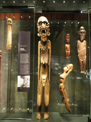 |
| Incredible museum in Santiago, Chili. These statues are from the Mapuche, a group that resisted the Inkas, and also were not defeated by the Spanish. |
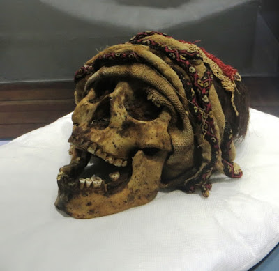 |
| Skeleton and textile from 2000 years or so ago. In the Andes, the high altitude and very dry environment sort of freeze dries bodies and the textiles they are wrapped in. Bodies are not generally buried but are kept around and brought out on special occasions to be remembered. |
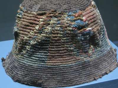 |
| Incredible how textiles still have original colours |
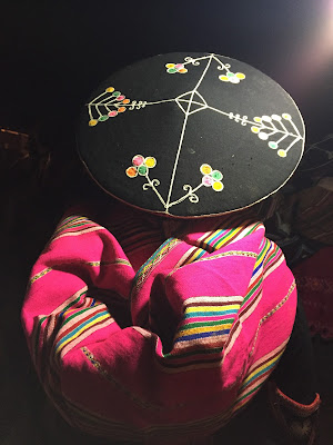 |
| Our homestay at Raqchi, south of Cuzco. The ruins are pre Inka that were then modified by the Inka. We got to dress in traditonal clothing, hand made and embroidered by the ladies. Through out South America I found it fascinating that usually the yarn of choice was acrylic dyed with bright primary colours, as being more modern. |
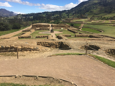 |
| Ingapirca, near Cuenca. Originally Canari which explains the curved walls, but modified by the Inka so you also got the incredible stone work as well as Inka trails. |
 |
| Our guide explaining that these were Canari - rocks piled haphazzardly with spaces filled with rubble. |
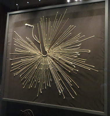 |
| Quipu. The Inka had no system of writing, but this was their way of keeping accounts. Recently a student at Harvard has begun to decipher the meanings. Read more here. |
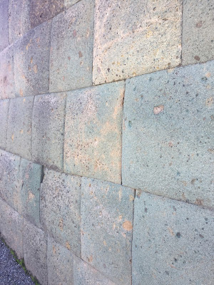 |
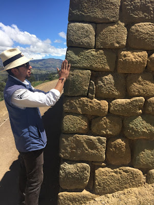
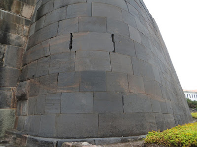
| Inka walls. These stones would have been shaped with other rocks as they had not learned to use iron. |
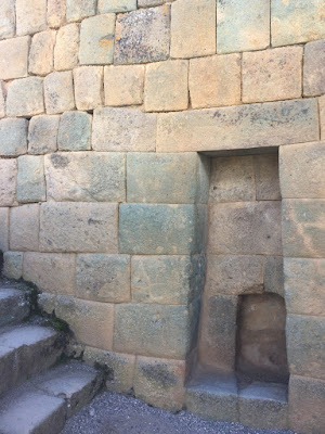 |
| An Inka archway |
 |
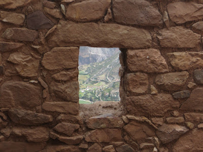
| A temple to water near Macchu Pichu. The Inka were passionate about building. Along the Wild Andes trek, we were hiking along traditional Inka trails. |
 |
| Some of the 40,000 km of Inka trails that are still being used throughout the Andes. |
 |
| A more informal Inka construction would have been used for an area that was not a dedicated temple - perhaps housing for servants. |
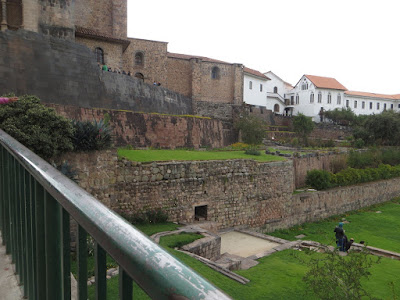 |
| Qoricancha/Convento de San Diego in Cuzco. The most important temple to the sun of the Inka. They considered this to be the center of the world. When the Spanish defeated the Inka, they built over top of this temple to create their most important convent in the area. Following major damage due to earthquake in the 1950s, the government rebuilt the complex to recognize both aspects and it is now a major museum. Even more fascinating was that the exhibition areas were host to modern art installations. |
 |
| One of the exposed Inka walls. |
 |
| In Popayan, southern Columbia, our guide pointed to this hill and indicated that this was probably an Inka site. About the farthest north that the Inka came. Columbia is much more influenced by other Indigenous groups. |
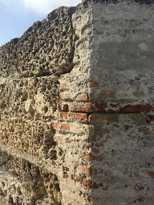
The Spanish
South Americans divide their history into three parts. Pre Columbian (before 1492), Colonial (Spanish rule) and Republican (the 1830s onward when there were battles for independence from the Spanish). By the early 1500s, the Spanish military and various missionary groups had established major cities including cathedrals and convents to convert the local indigenous people to Catholicism. Inka sacred sites were repurposed as churches, or taken apart to use the blocks as other buildings. Any of the sites that were too far from Spanish cities had crops planted on formal ceremonial grounds. Local indigenous artists decorated these buildings, often inserting local plants and animals as well as indigenous people into "traditional Spanish artwork".
 |
The restored church at San Pedro de Atacama. The church was built in 1557 and restored (again) in
1975
The original roof of cardon cactus held together with llama leather. The Spanish used what materials were available to create buildings in the style of home. |
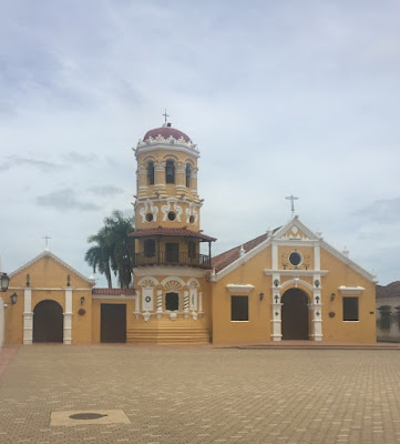 |
| An adobe church in Mompos, Columbia. Originally built in 1540, the most recent restoration was less than ten years ago. With adobe, this frequent "upkeeping" is not seen as making the building new. |
 |
| Sea wall at Cartagena built to keep out British pirates - Sir Frances Drake actually spent a year living in Cartagena. When you are building protection against ship cannons, the walls need to be much thicker but not as high as walls in a medieval castle. Our guide's explanation was that mosquitoes could be credited as the reason for why Columbians speak Spanish not English. During one major battle, the English were so weakened by malaria that they could not defeat the much smaller Spanish forces. |
Reading List – Check these library books out if you want to explore
South America from home
I’m a confessed library junkie. Tracpac allows me to search the libraries of
Alberta, request books and then have them delivered to my home library for pick
up. How cool is that? If you look at my records, you’ll see equal
numbers of books related to things fiber (weaving, quilting, embroidery,
dying…) and travel. I borrow books to
travel to places I wish to go to, but may never get to. And I borrow books to plan trips or I learn
about books while traveling and borrow them to read when I get home. Here’s my favorite books related to South
America, all of which I borrowed from the library.
Bridges, Lucas. To the Uttermost Part of the Earth. Originally written in 1938, then updated in 1949 and with an update in 2007 by Natalie Goodall (herself an incredible lady). Bridges was the son of the first Anglican missionary in Ushuaia and he grew up with the natives of Tierra del Fuego. I had tea with Tommy Goodall, his great nephew (Natalie’s husband and the current owner of the estancia). Great story. I wish I could find something similar about settling western Canada.
Chatwin, Bruce. On
Patagonia. This fellow spent 4 months
hitchhiking in Patagonia in the early 1970s.
He basically reinvented the way a travel book is written. Lots of fascinating stories about the people
he met, combined with history and geology all wrapped together. He had read Bridges' book while in the UK before traveling to South America.
Darwin, Charles. The Voyage of the Beagle . I learned that Darwin spent a lot more time exploring South America, including a stop in Tierra del Fuego, than he did in the Galapagos.
Guevera, Che. The Motorcycle Diaries. From Brazil to Peru by
motorcycle. Guevara developed his revolutionary ideas on this trip.
Heyerdahl, Thor. Kon Tiki. The first part of the adventure is traveling to the mountains to cut down trees for Kon Tiki...
Mcquarrie, Kim. Life and death in the Andes: On the trail of bandits, heroes and revolutionaries. Pablo Escobar, Che Guevara, Butch Cassidy and the Sundance Kid. The author takes us on a trip of all the fascinating characters of South American history. He had read both Bridges and Chatwin before starting his journey.
Theroux, Paul. The
Old Patagonian Express. Any travel book by Paul Theroux is worth checking out.
Meadows, Anne.
Digging up Butch and Sundance.
Menzies, Gavin. 1421
The Year the Chinese Discovered the World.
Did the Chinese actually send out three fleets to discover the
world? Did Columbus actually follow
their maps to the New World? A great
explanation for why natives in South America share genes with the Chinese and
why African plants also grow in South America.
James, Carol.
Fingerweaving Untangled. From Winnipeg she consulted with First Nations
to create this book.
Findley, Gerald.
Fingerweaving Basics.
American/Navaho processes.
Ian Tyson is one of my favorite singer songwriters He writes songs about the American cowboy without stopping at borders. Ross Knox has a phrase about traveling to "the wild Patagonia" that first had me searching for just where that was. The hundreds of miles of rugged isolation was fascinating as we traveled through. While at Torres del Paine, I learned that the vaquero in Jaquima to Freno is a
Chilean cowboy who dresses in clothing reflecting his Basque heritage.
Simon and Garfunkel El Condor Passa (if I could). One of my favorite songs. I heard it throughout the Andes and finally learned the rest of the story in Cuenca.
Luis Fonsi. Despascito. Was playing everywhere we traveled. Many great memories come with this song, and it makes me try to dance down the streets like a Latino
Qorikancha Convento de Santo Domingo. A song that I heard there and I'm glad I impulsively bought a copy because it isn't on youtube. Imagine a combination of Gregorian Chant with traditional Andean flutes and rhythms. Perfect for this combination most important Inka site with major Spanish convent.
Inti Illimani an internationally known Andean group. Their El Condor Passa complements Simon and Garfunkel perfectly.
Antonio Jobim The girl from Impanema. I have a selfie with him on the beach in Rio.
La Bomba de Tiempo. Incredible Buenos Aires drum group. They play every Wednesday at their practice hall, then lead everybody in a parade after midnight to a local bar to continue the party.
Mercedes Sosa. I first heard her on CKUA, of course.
Brazilian Fado and Salsa
Argentinian Tango
Sepultura if you are a heavy metal fan. Apparently South America is a hotbed of heavy metal music and all the major bands have played there.
 After flying to Rio de Janiero, I spent almost five months traveling overland in an orange and white truck to Cartagena by way of the southern most tip of South America at Ushuaia. The distance was almost 20,000 km.


